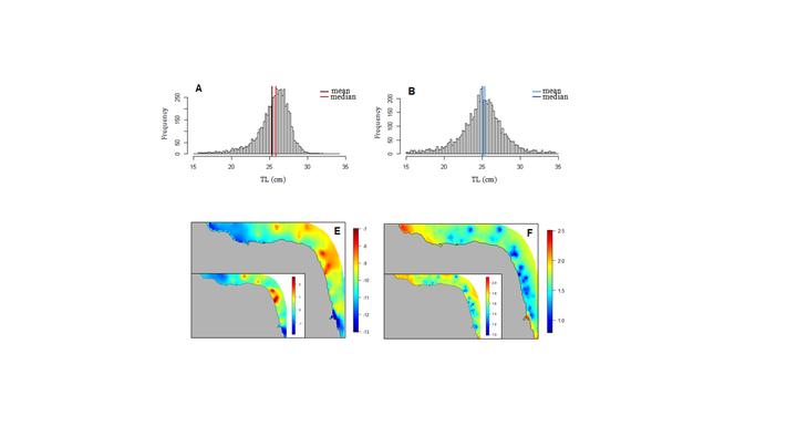
Abstract
Understanding the spatial distribution and identifying environmental variables that drive endangered fish species abundance are key factors to implement sustainable fishery management strategies. In the present study we proposed hierarchical Bayesian spatial models to quantify and map sensitive habitats for juveniles, adults and overall abundance of the vulnerable lane snapper (Lutjanus synagris) present in the northeastern Brazil. Data were collected by fishery-unbiased gillnet surveys, and fitted through the Integrated Nested Laplace Approximations (INLA) and the Stochastic Partial Differential Equations (SPDE) tools, both implemented in the R environment by the R-INLA library (http://www.r-inla.org). Our results confirmed that the abundance of juveniles and adults of L. synagris are spatially correlated, have patchy distributions along the Rio Grande do Norte coast, and are mainly affected by environmental predictors such as distance to coast, chlorophyll-a concentration, bathymetry and sea surface temperature. By means of our results we intended to consolidate a recently introduced Bayesian geostatistical model into fisheries science, highlighting its potential for establishing more reliable measures for the conservation and management of vulnerable fish species even when data are sparse.